
Hall of Maps
Still under construction. You can browse some charts, but a whole world map will be available soon. Be among the first to be notified!
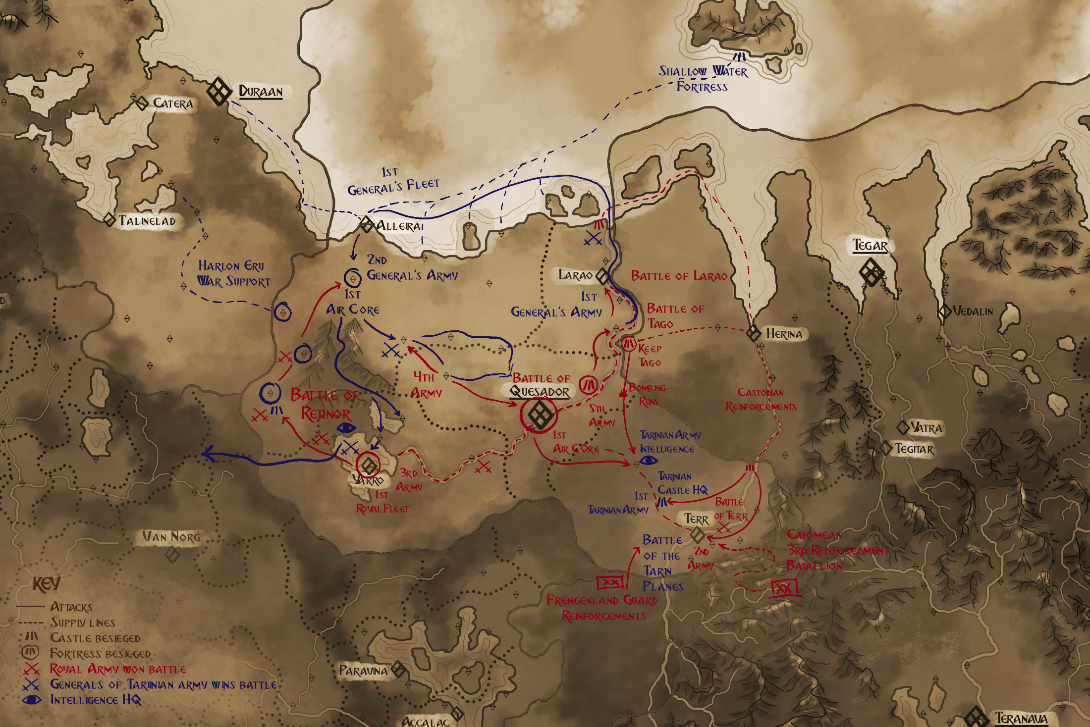
BATTLES FOR AMUREA
This map was created during the "Amurean Civil War" to monitor the advances of Royal (colored red) and General (colored blue) troops. This major event that ended just about 7 years ago has already led to many changes in diplomacy between countries as both "The Dynasty" and the "Honordom Empire" were involved directly or indirectly in the conflict.
CUTOUTS
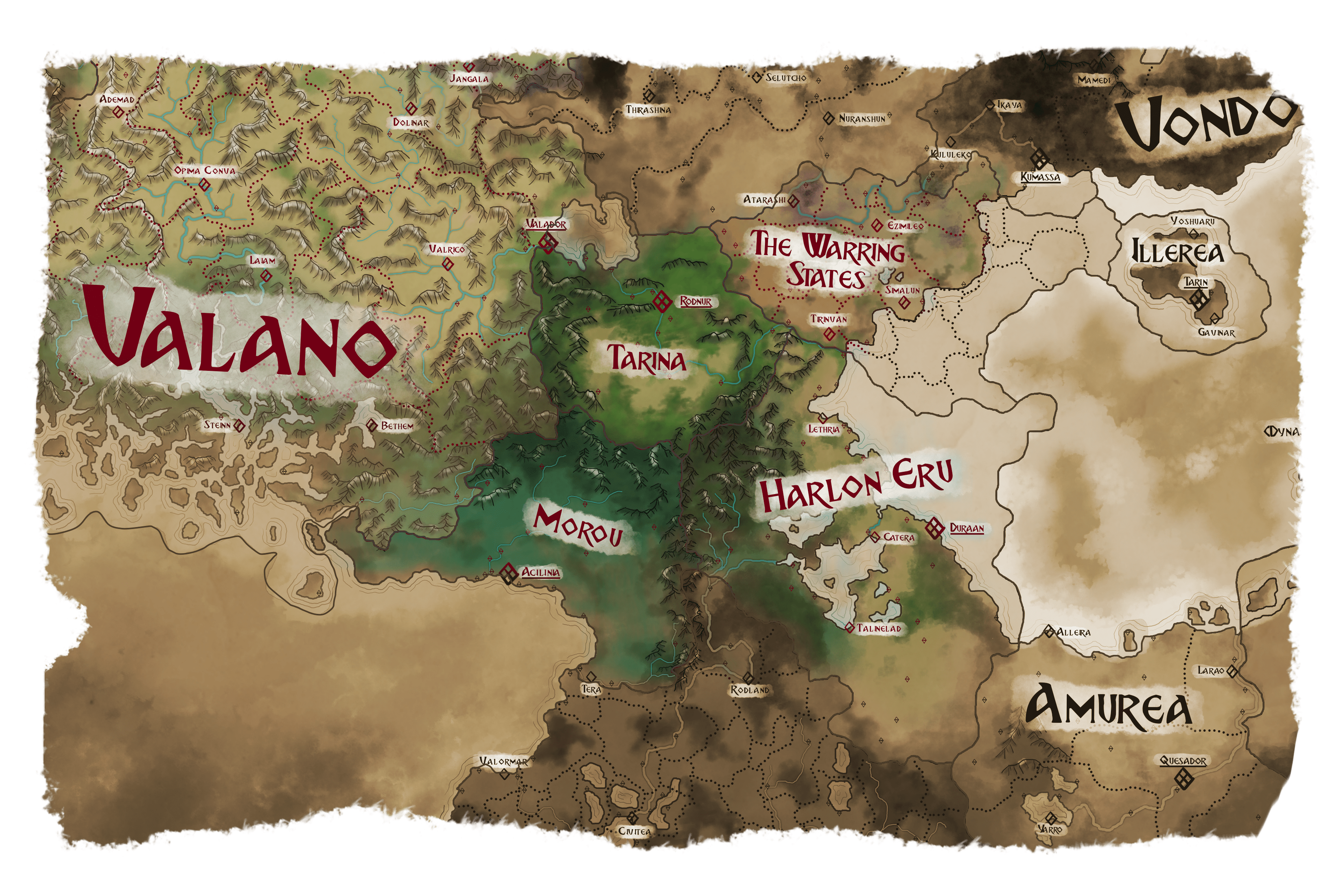
This cut-out shows the central Mistvail Mountain Region. It is the location of some of the most extensive cave networks that have harbored mighty civilizations like the Murr ever since the dawn of time.
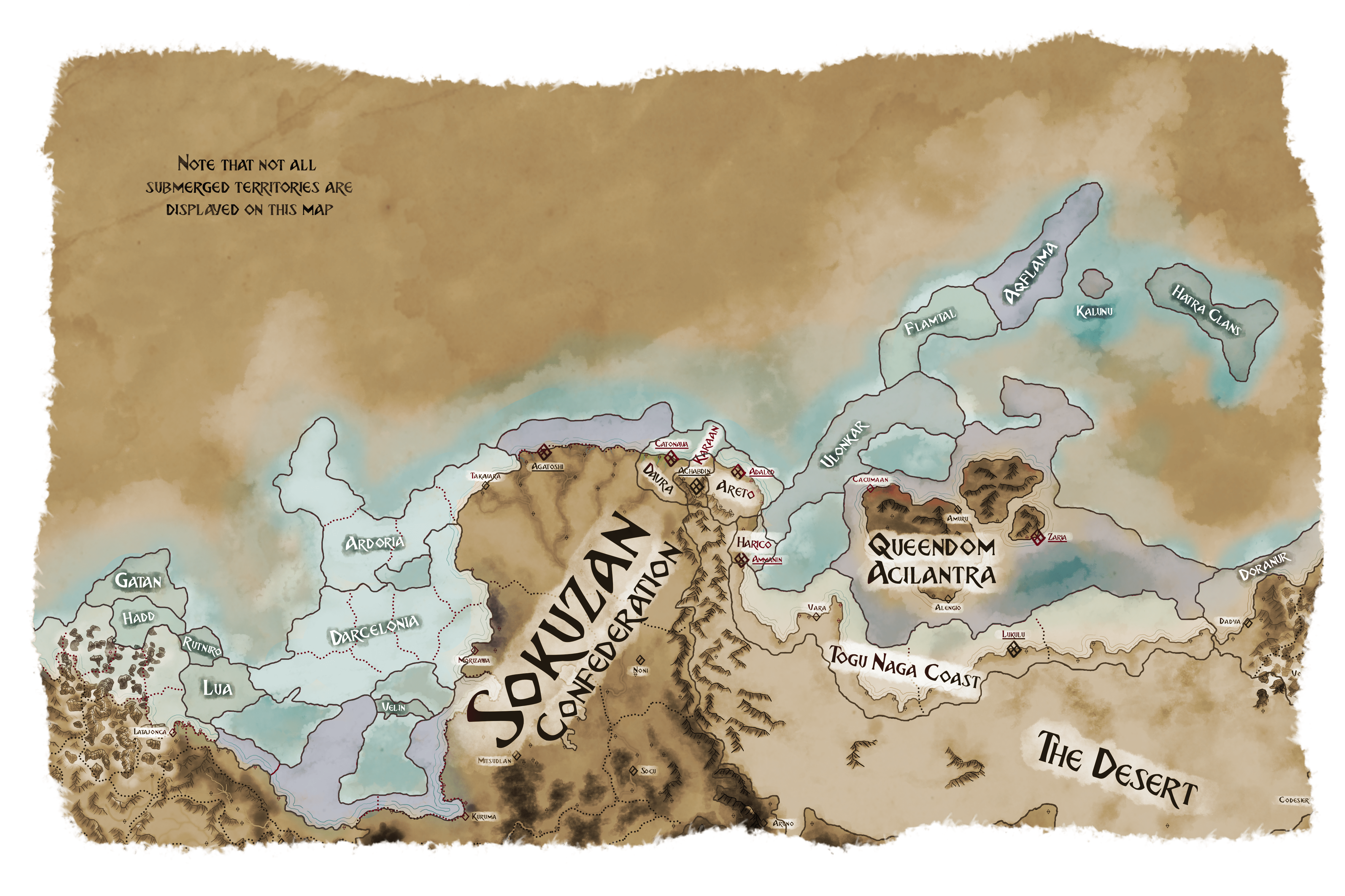
The cutout below shows the northern seaworldler domains. It has only been recently that airworldler and seaworldler started to trade. But ever since much has happened in the underwater kingdoms with societies transforming more like the airworldler states, creating recognized borders and building more fixed monuments.
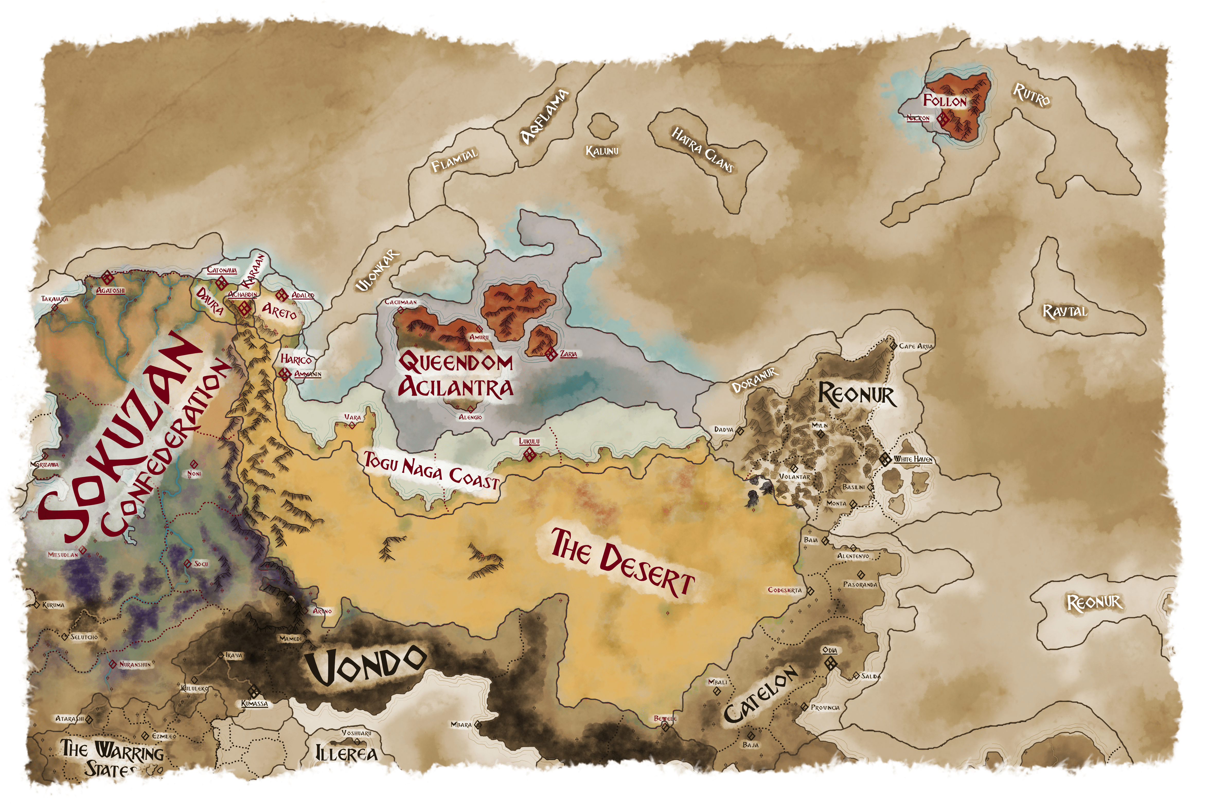
The hot north is one of the most difficult regions to live in. Yet life found a way. These days sprawling states like the Queendom Acilantra, the Sokuzan Confederation, and the four Kingdoms amongst others share this territory.
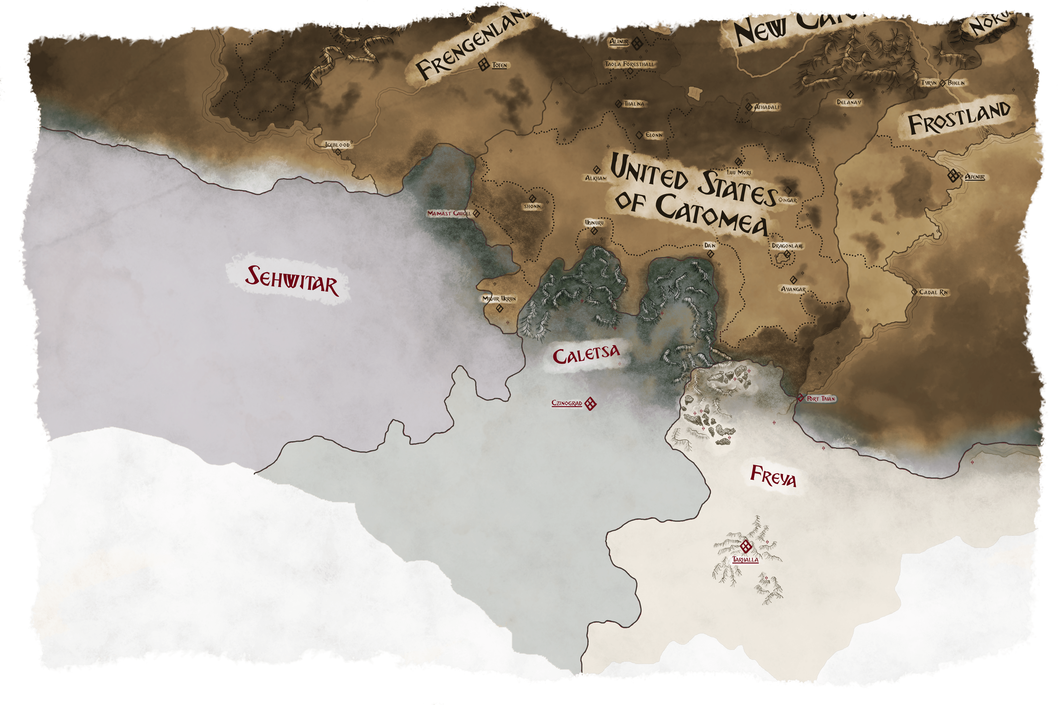
Below you can behold a glimpse of the cold south. Within it are three countries that could be hardly more different from each other. Although we do not know much about Sehwitar because nobody who has gone there has ever returned in recorded history.
Finally, we have cut out the Eon Mountains as it contains many connected cave systems that have over the history of humankind been deepened and extended with certainly the most comprehensive network being located in Norus. It can only be rivaled by the Murr Caves in the Mistvail and perhaps, maybe, by Acilantra's and Valano's.

